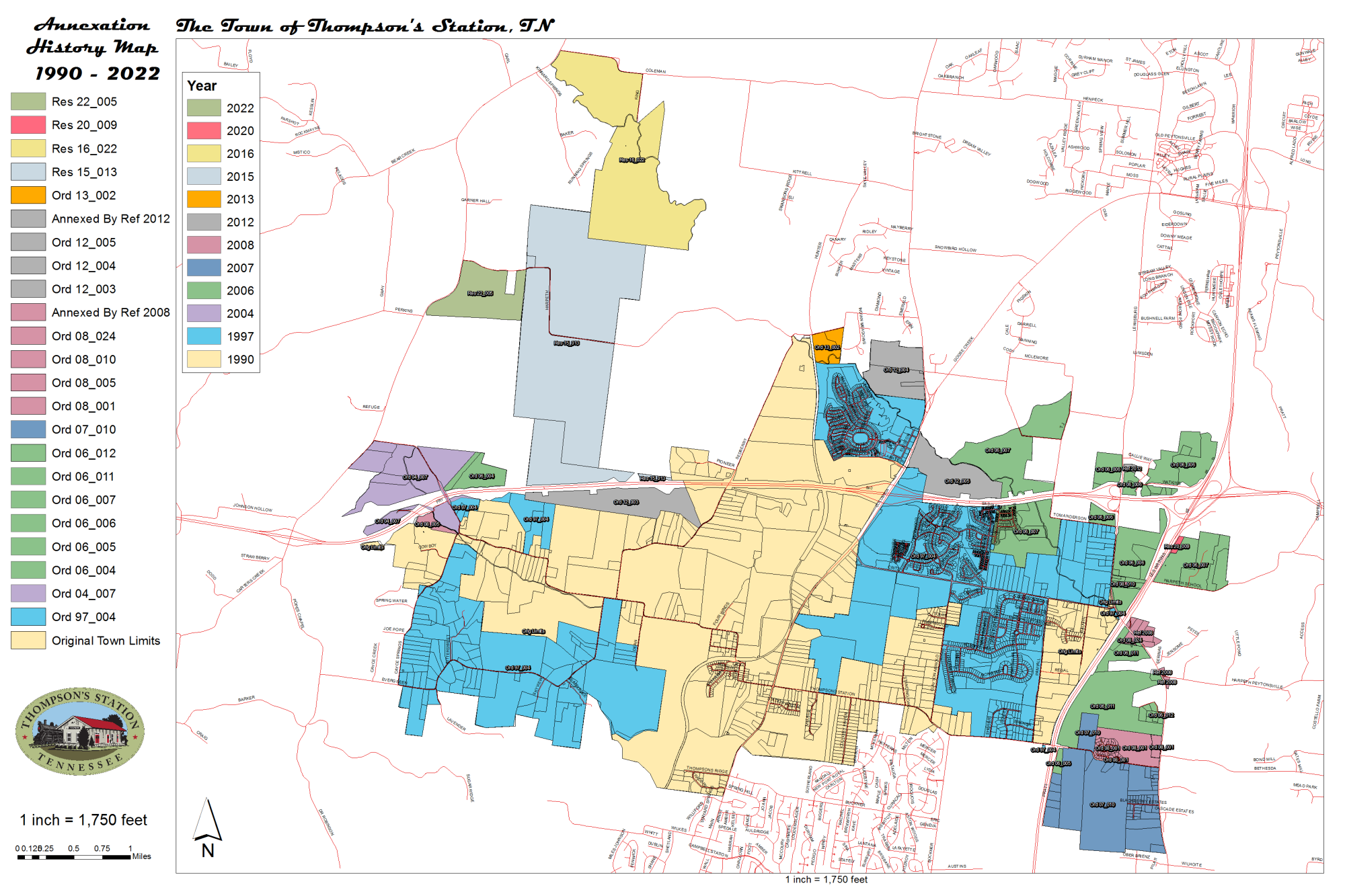
The map above shows the town annexations chronologically by ordinance and referendum. (example: Ord 06_004 is an annexation ordinance from 2006 and was the fourth ordinance of the year) Annexations are grouped by color and year.
1990 - The original Town boundary was created, including property from I-65 to Cowboy Ln.
1997 (Ord 97_004) - Large cuts of land were annexed to the Southwest and East, including future subdivision land for Tollgate Village, Fields of Canterbury, Bridgemore Village and Pecan Hills.
2004 (Ord 04_007) - Several properties off the West end of Thompson's Station Rd West were annexed.
2006 (Ord 06_004, 06_005, 06_006, 06_007, 06_011, 06_012) - Numerous properties on the East side of Town were annexed, plus one on the West side.
2007 (Ord 07_010) - Properties in the area East of I-65, West of Lewisburg Pk and South of Thompson's Station Rd East were annexed.
2008 (Ord 08_001, 08_005, 08_010, 08_024 and Referendum) - Several small properties off Lewisburg Pk were annexed including the Arbor Lakes subdivision.
2012 (Ord 12_003, 12_004, 12_005 and Referendum) - Seven parcels were annexed along the North side of Town.
2013 (Ord 13_002) - The Ozzad Property was annexed by the Town.
2015 (Res 15_013) - Three properties northwest of Town were annexed by Resolution in November, 2015.
2016 (Res 16_022) - Three properties northwest of Town were annexed by Referendum in December, 2016.
2020 (Res 20_009) - One property northeast side of Town to add to the Graystone Quarry Parking was annexed by Referendum in June, 2020.
2022 (Res 22_005) - One property northwest side of Town was annexed by Referendum in March, 2022.
